Notable projects

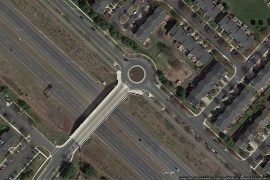
INTERCHANGE IMPROVEMENTS PROJECT

BALTIMORE CITY, MD

MARYLAND TRANSPORTATION AUTHORITY (MDTA)

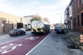
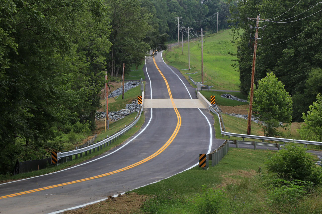
WTB led the overall project management, planning, conceptual engineering (15%) design and environmental documentation services for the MDTA’s I-895 / Baltimore Harbor Tunnel Toll Plaza & Interchange Improvement Project in Baltimore, Maryland. Due to proposed interchange improvements along I-895, which require Federal Highway Administration (FHWA) approval, the project is subject to the National Environmental Protection Act (NEPA). The NEPA process included: compiling an inventory of existing traffic, engineering, and environmental data; evaluating alternatives; determining potential impacts; agency coordination; and public outreach.

To support engineering design and future permitting, WTB conducted GIS desktop screenings, topo surveys and field visits. Survey data was collected for right-of-way, natural resources, existing utility designation and storm drain structures. Natural environmental, socioeconomic and cultural resources identified during the GIS screening – such as wetlands/waterways, 100-year floodplain, Chesapeake Bay Critical Area, trees, forested slopes, bald eagle nests, historic properties and potential environmental concerns – were reviewed during field visits.

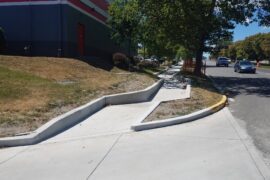
Conceptual (15%) design plans were developed for various build alternatives that considered existing and planned utilities, erosion and sediment control, stormwater management (SWM), and traffic control. The various alternatives were evaluated to see which best met the Purpose & Need of the project. Potential resource impacts were avoided and minimized where possible.

WTB coordinated closely with MDTA and the Federal Highway Administration (FHWA), regulatory resource agencies and key stakeholders to gather information, discuss proposed improvements and identify any challenges to future permitting and schedules. Key stakeholders included:

  • MDTA’s internal agencies (Police, Operations, Engineering and Construction),
  • Maryland Department of Transportation Maryland Port Administration (MDOT MPA),
  • Baltimore City Department of Transportation, and
  • CSX

WTB coordinated with state and federal regulatory agencies on resources, permitting thresholds and potential mitigation, including:

  • FHWA,
  • NOAA-NMFS,
  • S. Fish & Wildlife Service,
  • MD Historical Trust (MHT), and
  • MD Department of Natural Resources (DNR).

WTB worked collaboratively with MDTA and a specialized public outreach firm to bring public awareness to the project. Clear and consistent information was made available to the public, including a project Fact Sheet, meeting announcements via MDTA’s Facebook and Twitter accounts, and a project website.

WTB prepared a Categorical Exclusion (CE) NEPA document summarizing the projects’ Purpose and Need, existing resources, potential direct and indirect impacts that could result from proposed improvements, public outreach and agency coordination. As part of the NEPA documentation process, WTB managed development of an Interstate Access Point Approval (IAPA) for proposed modifications to the I‑895 interchange.

Key Services: Client Project Goals:
  • Project Management
  • Conceptual Engineering Design
  • NEPA Environmental Documentation
  • Survey & Field Visits
  • GIS Screening & Mapping
  • Agency Coordination
  • Public Outreach
  • Section 4(f) Coordination
  • Air & Noise Analyses
  • Environmental Justice Evaluation
  • Replace the existing toll booths with overhead electronic gantries to collect tolls at highway speeds (while maintaining the current ability to weigh and inspect commercial vehicles);
  • Modify the existing interchange ramps to meet highway speed criteria; and
  • Update the existing I-895 bridges over Frankfurst Avenue, BHT campus storage area and Childs Street


The Capital Improvement Program (CIP) project included replacing two existing pipe culvert structures with two separate bridges to carry Gas House Pike over Linganore Creek. The primary structure was built in 1962 and consisted of a four-cell corrugated metal pipe (CMP) culvert with concrete headwalls and wing walls. The bridge inspection report prior to initiating design for this project resulted in the structure being listed in serious condition. The adjacent smaller structure also required replacement due to frequent flooding which resulted in safety issues for the traveling public.

The design of the project was initiated on November 2015. The new structures and proposed roadway profile were designed to pass the 10-year storm. An overflow pipe culvert was placed between the two new bridges to further alleviate flooding of the roadway.

The project required a full range of engineering services including topographic and field surveys; wetland identification; preparation of right-of-way plats and metes and bounds descriptions; property and easement acquisition; coordination with utility companies; hydrologic and hydraulic analysis; environmental documentation and environmental permitting approvals; storm water management (SWM) design; coordination with reviewing agencies; obtaining soil, roadway, structural, and SWM borings; foundation and scour analysis; final bridge and approach roadway design; and preparation of contract plans, specifications and engineer’s cost estimate.

The primary bridge structure is a 77′ single span prestressed concrete girder bridge with concrete abutments supported on a caisson foundation. The secondary structure is a 52′ single span prestressed concrete girder bridge also with concrete abutments and a caisson foundation.

SWM redesign was required due to stream channel migration adjacent to the SWM site and damages that occurred from the September 22-23, 2021 10-year storm event. These unforeseen events required the County, WTB, Contractor, and MDE to swiftly conduct post-storm reviews and quickly collaborate on necessary revisions to the SWM design. MDE required stream repairs as part of the SWM recisions which included an imbricated riprap wall system over 170 feet in length and approximately 8 feet in height.

This is an excellent example of a project where all parties, including the County, consultants, reviewing agencies, utility owners, developer, contractor, and adjacent landowners worked together to accomplish the goal of replacing the structures in a short construction duration. The Project Team worked together to develop roadway and bridge improvements in order to deliver an outstanding project and set a construction schedule to meet the needs of the community.


US 40 SIDEWALK STUDY AND FINAL DESIGN FROM WALNUT STREET TO EASTERN BOULEVARD
HAGERSTOWN, MARYLAND
MARYLAND DEPARTMENT OF TRANSPORTATION – STATE HIGHWAY ADMINISTRATION (MDOT SHA)

The MDOT SHA commissioned two prior studies addressing pedestrian safety concerns along US 40 Dual Highway (US 40) in Hagerstown. The prior studies identified potential causes of pedestrian injuries and fatalities in the corridor, such as missing sidewalk links and pedestrian signals, insufficient intersection lighting, sight distance issues, and inappropriate mid-block crossings. WTB was tasked with determining impacts and costs associated with providing the recommended sidewalks, pedestrian signals, signing, median fencing, and lighting along US 40.

WTB conducted field investigations to identify ADA non-compliant sidewalk and sidewalk ramps, missing sidewalk links, and the existence of environmental features (streams, wetlands, and RTEs). WTB conducted topographic surveys and utility designations at locations where SWM facilities and pedestrian signals were proposed. WTB’s scope included the development of sidewalk, sidewalk ramp, MOT, SWM, ESC, signing and marking, pedestrian signal, and interconnect design.

Sidewalk and sidewalk ramp design included: typical sections development; special ramp details (where standard details could not be applied); curb extensions to shorten pedestrian crossings; bus stops, bus pads, and shelter pads; and accommodation of adjacent developer work. Many of the 75 sidewalk ramps were individually designed and incorporated a Type A curb “retaining wall” (less than 24” height) behind them to minimize above ground utility and right of way impacts, and to minimize grading and limits of disturbance. The design required reconstruction of 30 business entrances for ADA compliance and included stamped concrete crosswalks at three locations in downtown Hagerstown.

Environmental Site Design (ESD) was investigated to the maximum extent practicable (MEP), identifying grass swale locations within the median of US 40. Swale locations were chosen to avoid existing utilities and R/W impacts. Geotechnical soil borings indicated shallow rock within the median which precluded the use of bioswales and SWM facilities with infiltration or filter material. The project design was revised to maximize impervious area removal and minimize new and reconstructed impervious areas. There was no increase in the 10-year storm discharge, eliminating peak discharge management. ESC and MOT phasing were designed to provide multiple separate work areas to allow the contractor flexibility.

WTB performed existing traffic signal, signing and marking, and interconnect field inventories to determine if existing traffic equipment needed to be replaced or upgraded. New pedestrian APS/CPS equipment was designed and coordinated with new sidewalk ramps at three intersections. Signing and pavement marking design was prepared along the corridor. WTB prepared bid documents including plans, specifications and the engineer’s estimate ($1.4M), and assisted MDOT SHA in the preparation of the Invitation for Bids and addenda.

During Phase V, WTB responded to issues associated with unforeseen conditions including utilities, addressing the existing pavement section, and property owner concerns. In all instances, red or greenline plans, estimate revisions and SWM permit modifications were promptly prepared and submitted to MDOT SHA in order to avoid impacting the contractor’s schedule.

NORTH AVENUE CORRIDOR IMPROVEMENTS, HILTON STREET TO MILTON AVENUE BALTIMORE, MARYLAND
MARYLAND DEPARTMENT OF TRANSPORTATION – MARYLAND TRANSIT ADMINISTRATION (MDOT MTA)

The North Avenue Rising project supports economic revitalization along North Avenue through increasing mobility, improving transit reliability, and by broadening access for corridor residents to economic opportunity throughout Baltimore. The project constructed various improvements along North Avenue including: ADA compliant sidewalk, dedicated bus lanes supported by transit signal priority, enhanced bus stops, roadway repaving, and bikeshare parking.

The North Avenue Rising project was funded through a collaboration between Federal, State, and local funding. The State of Maryland and Baltimore City won funding for the project from the US Department of Transportation through the Transportation Investment Generating Economic Recovery (TIGER) grant program. The total project budget for North Avenue Rising was $27.3 million which included $10 million from the TIGER grant, $14.7 million in funds committed by MDOT, $1.6 million from US DOT’s Federal Highway Administration, and $1 million from Baltimore City. In response to the successful TIGER grant award to MDOT MTA, The Wilson T. Ballard Company (WTB) was selected to design a complete and comprehensive multi-modal improvement of North Avenue from Hilton Street to Milton Street, a total length of 4.9 miles.

The planning phase of this project involved concept development and selection, detailed cost estimates and two rounds of public involvement within a five-month time frame. We established a detailed milestone schedule within the challenging framework dictated by the terms of the TIGER grant, weaving together subconsultants’ roles, public involvement landmarks, permit submissions, agency reviews, etc. to meet a combined planning/contract document schedule of less than one year. Due to TIGER grant funding constraints, the scope of the project improvements and cost estimates required extensive coordination between the MDOT MTA and the Baltimore City Department of Transportation to arrive at a preferred concept. Working with MDOT MTA Planning, the WTB Team worked iteratively through multiple resurfacing, streetscape, curb extension and other improvement scenarios to try and meet the project needs, cost constraints and citizen requests. The planning phase of the project culminated in 2017 with concept selection.

WTB headed the field surveys and utility investigation, coordinating with several subconsultants. We developed full topographic mapping using conventional topographic and aerial surveys; and we completed utility inventories to Level A, using GIS, designating and test pits.

Design elements included dedicated bus lanes; enhanced streetscape elements such as new lighting, traffic signals, curb extensions and street trees; enhanced bus shelters; roadway resurfacing and repaving; transit signal priority; new neighborhood bicycle routes, bike share stations and access improvements to the Penn-North Metro Station. We worked closely with the Maryland Department of the Environment (MDE) to compress stormwater management (SWM) and erosion and sediment control (ESC) review milestones, obtaining all permitting within 10 months. We also played a major role in helping MDOT MTA research and implement the first ever application of red asphalt using red dye and red aggregate in the State of Maryland.

We managed the design team preparing the plans, specifications and estimate; utilizing our subconsultant team for 40% of the project length. By utilizing multiple subconsultants we were able to expedite production of a 400+ sheet set of final plans and ensure we exceeded the contract requirements for minority business enterprise (MBE) involvement. The advertisement and bid process went better than anticipated, allowing construction to begin several months ahead of schedule.

PRINCE GEORGE’S COUNTY, MARYLAND

The Takoma Park Langley Park area is located in in Prince George’s County, near the Montgomery County border, just north of the Washington, D.C. line, in a densely populated, culturally diverse community, with the highest volumes of non-Metro transit use in the D.C. Metropolitan area. The location known as “the Crossroads”— near the intersection of MD 193 (University Boulevard) and MD 650 (New Hampshire Avenue) is a well-known major hub of transit and pedestrian activity. By 2005, the growth in vehicular, pedestrian and bus traffic converging at the Crossroads resulted in a sharp increase in the rate of pedestrian crashes and pedestrian fatalities. Planners for the Purple Line recognized that a bus transit center at or near the Crossroads would address pedestrian safety and bus operations as well as the Purple Line station needs in the long term.

In late 2005, the Maryland Transit Administration (MTA) retained The Wilson T. Ballard Company (WTB), to begin planning services for the Takoma Langley Crossroads Transit Center to be located at the site of the Taco Bell Restaurant in the southern portion of the Langley Park Shopping Center. WTB lead the project from initial planning to final commissioning.

The project required a full range of engineering services, including geotechnical analysis, field surveys (topography, property location, and stakeout); right-of-way plats and metes and bounds descriptions; coordination with utility companies; foundation and structural steel design; preparation of contract plans, specifications and engineer’s cost estimate; participation in review meetings with Washington Metropolitan Area Transit Authority (WMATA) and other transit providers; review of shop drawings and consultation during construction. WTB provided all civil/site and structural design services and supervised a diverse team of architects, mechanical and electrical engineers, and landscape and irrigation consultants through planning, design and construction. Public involvement and environmental services, including all permit applications and hazardous waste assessment, were also provided.

Although the site’s location is optimal in terms of proximity to more than a dozen major bus routes with four different transit providers (WMATA, Montgomery County – Ride On, Prince George’s County – The Bus and University of Maryland Shuttle), the site’s size is limited to just over one acre in size in order to minimize impact to the adjacent shopping center. Working closely with the Maryland State Highway Administration (SHA), the Langley Park Shopping Center and WMATA, WTB used real time computer simulations and full scale testing methods to develop a unique compact 12-bus bay design that accommodates the 60+ peak hour buses, with varying headways and layovers, and the hundreds of hourly passenger boardings and alightings. The bus platforms are covered by a 21,000 square foot parabolic glass-covered space-frame to allow natural light and ventilation while protecting passengers from the weather. In addition to the bus bays and passenger platforms, the site includes a 1,152 SF Transit Facilities Building with lobby, restrooms, offices and ticket vending. The project incorporates state-of-the-art sustainable building and site design features, including solar panels in the glass roof that will fully support building electrical use; rain water harvesting, and a grey water irrigation system to support the plantings in the bioretention areas. The bus platforms will be equipped with real time passenger information displays with LED Next Bus arrival signs and other important route and schedule information.

The project was opened to the public in Winter 2016.


REPLACEMENT OF BRIDGE NO P-403

BADEN NAYLOR ROAD OVER ROCK CREEK

PRINCE GEORGE’S COUNTY, MARYLAND

On September 7, 2011, the north abutment of Bridge No. P-403 (Baden Naylor Road over Rock Creek) was severely undermined due to scour, resulting in the loss of the abutment and collapse of the bridge and approach roadway during Tropical Storm Lee. Baden Naylor Road was closed immediately to traffic, resulting in more than a 6 mile detour. The existing structure was a single-lane two span continuous reinforced concrete slab bridge. The substructure consisted of two reinforced concrete abutments with wing walls and a solid-shaft reinforced concrete pier all on spread footings.

In late 2011, Prince George’s County DPW&T created a fast track project utilizing on call engineering consultant, The Wilson T. Ballard Company (WTB), and on call bridge contractor, Rustler Construction, Inc. The design team included AB Consultants, Inc. to perform setting survey control; geotechnical investigation; and roadway, storm water management, storm drainage, and erosion and sediment control design.

The project required a full range of engineering services including wetland identification; field surveys (topography, stream cross sections, property location, and boring stakeout); deed research; preparation of property mosaic, right-of-way plats and metes and bounds descriptions; coordination with utility companies; participation in wetland jurisdictional review; hydrologic and hydraulic analysis for out-of-kind structure replacement; environmental documentation; coordination with reviewing agencies; foundation and scour analysis; preliminary and final bridge design; preparation of contract plans, specifications and engineer’s cost estimate; participation in review meetings with County; review of shop drawings and consultation during construction.

During the preliminary design phase, fabricators were contacted concerning availability of material, cost and delivery time of the superstructure beams, either precast prestressed concrete or structural steel. The delivery time for the prestressed concrete box beams was a third of the time as that for a steel superstructure and less costly, which were important factors in the overall project. The County selected the single span 72’ long prestressed concrete box beam bridge alternative on March 15, 2012, at which time the Design Team initiated preparation of Semi-Final Plans.

At the Semi-Final stage, the County began negotiating the cost of the project with the Contractor. The Contractor was given Notice-to-Proceed on December 3, 2012, with a completion time of 180 calendar days. Construction was substantially complete and the bridge opened to open to traffic at the end of June 2013, 15 months from the formal design notice-to-proceed.

In approximately 18 months (including in-stream restriction) this team designed, permitted, acquired right-of-way, relocated aerial and underground utilities, removed the existing structure, and constructed a larger hydraulically appropriate bridge and approach roadway.

The coordination between all parties, including the County, consultants, reviewing agencies, utility owners, contractor, and adjacent landowners, working together, accomplished the goal of putting the road back in service as quickly as possible. The Project Team collaborated on unique strategies and solutions in order to deliver an outstanding project on an accelerated schedule to address the concerns of the local community.

As a result, the Baden Naylor Road bridge project was awarded the County Engineers Association of Maryland (CEAM) and MdQI’s 2014 Project of the Year.

MDQI-and-CEAM-Awards-web

Montgomery County/Prince George’s County

The Intercounty Connector (ICC) is an 18 mile design-build multi-modal highway connecting I-270 and US 1 in Montgomery and Prince George’s counties. (Maryland State Highway Administration)

During project planning, the Wilson T. Ballard Company served as co-General Engineering Consultant (GEC) taking a corridor-wide lead on right of way, utilities, H&H, air & noise analysis and the development of alignment options. We attended public outreach meetings, coordinated avoidance and mitigation options with the NEPA team, and developed cost estimates for the alternatives and assisted SHA and FHWA in the mega-project cost estimate review.

As a major subconsultant to the GEC Joint Venture throughout the procurement and construction phases of the project, our team continued a corridor-wide lead in right of way, utilities, air and noise analysis. Our staff served as overall design compliance oversight management for Contracts B and D/E Modified, and provided design compliance oversight for roadway and drainage design under Contract B. We provided an Independent Environmental Monitor (IEM) to oversee mitigation projects within the Northwest Branch. Staff assisted in the management and design of several environmental stewardship and compensatory mitigation projects.

Our team was also instrumental in the development of design criteria related to stormwater treatment in the Montgomery County Special Protection Areas for the Paint Branch and Gum Springs tributaries, and design performance specifications for the ICC / MD 650 single point urban interchange (SPUI) and the ICC / US 1 continuous flow intersection (CFI).

Throughout design and construction, ICC and the GEC won numerous awards including most recently the Engineering Society of Baltimore’s 2015 Project of the Year Award.

MDQI-Partnering-Award-2013 Engineering-Society-of-Baltimore-Award-2016 FHWA-Award-2007_web